RPAS for landfill management: A Proof of Concept
ASG Mapping initiated this project in partnership with a local waste management organization. This organization had been looking into implementing an RPAS program but had been continually challenged by a lack of personnel resource. Assigning an existing personnel to do research on regulations, certifications, data collection and processing workflows takes that person away from his/her daily work responsibilities. To circumvent this situation, ASG Mapping and the waste management organization came together to implement a Proof of Concept (POC) project that benefited both organizations. This POC provided advantages at minimal cost to both organizations. The waste management organization gained valuable insights on RPAS field operations, data processing workflow, feasible data accuracy, and how RPAS integrates into their current management operations workflow. For ASG Mapping, the POC allowed it to gain practical knowledge and experience in RPAS field operations specific to a waste management environment and how RPAS data can support waste management operations.
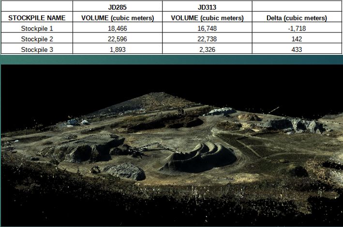
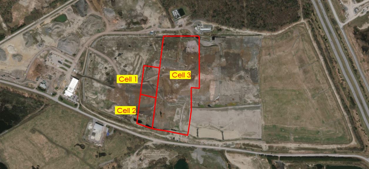
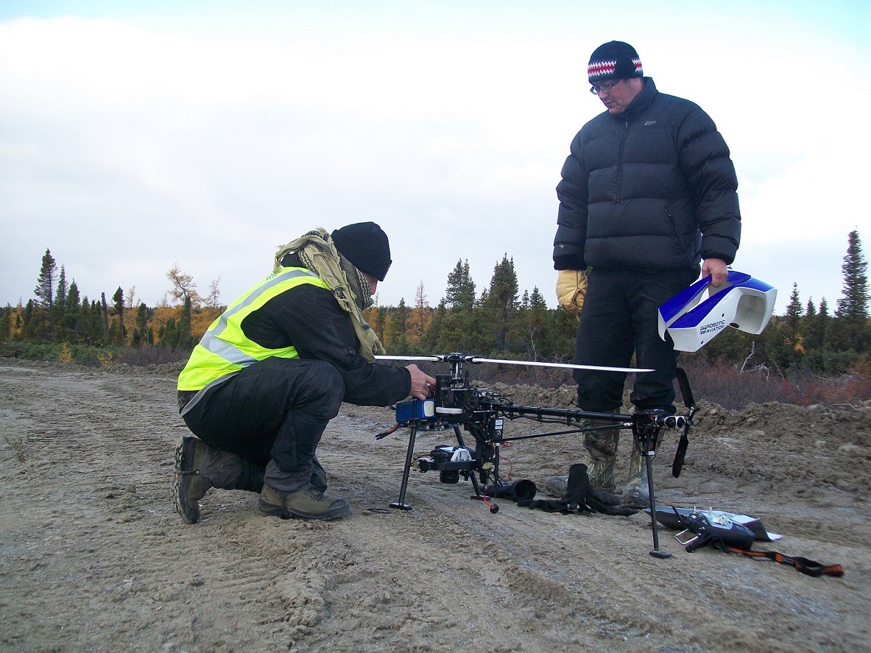
ASG Mapping collected data over two time periods to quantify volume of stockpiles of daily cover and three landfill cells. Two data collection events were done to be able to quantify volume changes. A custom 3DR Solo RPAS system integrated with a digital camera was used in the POC. Ground Control Points (GCPs) and check points were laid down over the project area to provide an assessment of data accuracy. Digital Elevation Models (DEMs) of the stockpile area and the three landfill cells were created from the RPAS data and used for the volume calculations. To better align with the waste management organization's workflow the DEMs were also converted to the DWG format.
Volumetric data derived from RPAS data allows for more efficient management of stockpile materials for daily cover, compaction rates, and determining the remaining airspace for each landfill cell.
UAV Imagery Data: Quality Standards and Interoperability Project
This project was made possible with a Contribution Agreement from Natural Resources Canada through the GeoConnections program. Deliverables of the project included the development of a document detailing best practices guide for the collection of high quality, positionally accurate, and interoperable geospatial data using Unmanned Aerial Vehicles (UAVs). Another deliverable is to produce a document reviewing existing metadata creation tools as part of the interoperability component. The focus was the collection of geospatial data in northern communities. However, case studies and testing were conducted in Ottawa (Ontario) and in Nicolet (Quebec).
Project Sites and Methodology:
Three sites in Ottawa and one site in Nicolet were selected for the case studies. One of the sites in Ottawa was located in the Marlborough Forest and the two others in St. Isidore. These sites were selected to enable data collection over a mixed forest and over agricultural fields, respectively. The site in Nicolet was selected because it allowed for data collection over a wetland. Furthermore, this site was already used in a previous project by one of the collaborators which will allow the comparison of results from both projects.
Lessons learned and experience gained from the case studies were used to guide UAV data collection in Kuujjuaq, an aboriginal community in northern Quebec. Positional accuracy was determined by laying photo targets on the ground at appropriate locations within the sites. Photo target locations were determined using a Trimble ProXRT GPS with realtime differential corrections provided by OmniStar. This setup gives horizontal accuracy of about 10-cm and vertical accuracy of about 30-cm. Photo targets were divided into Ground Control Points (GCPs) which were used in performing bundle adjustment and Check Points used in evaluating the positional accuracy of the resulting orthomosaics.
Vegetation health monitoring
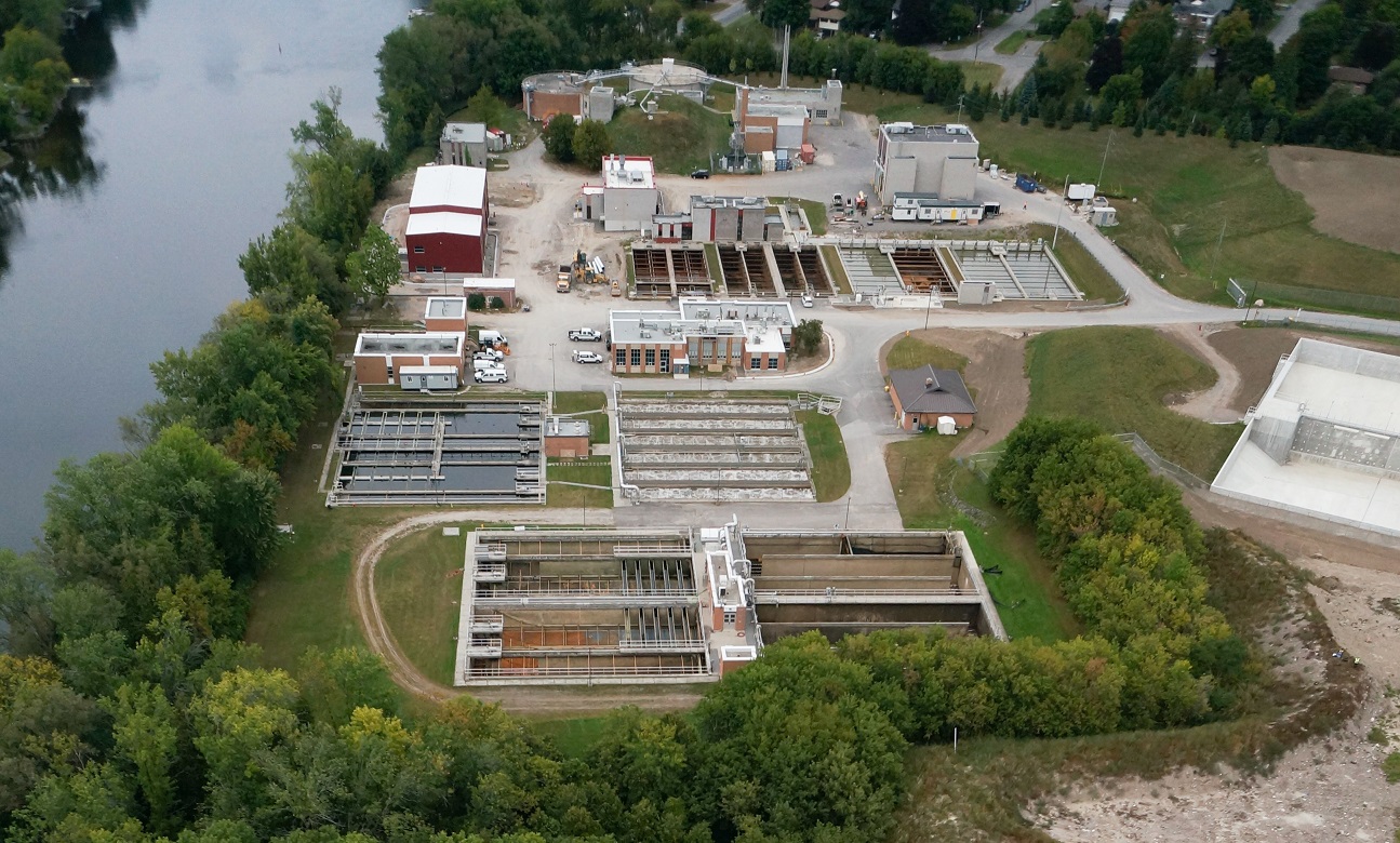
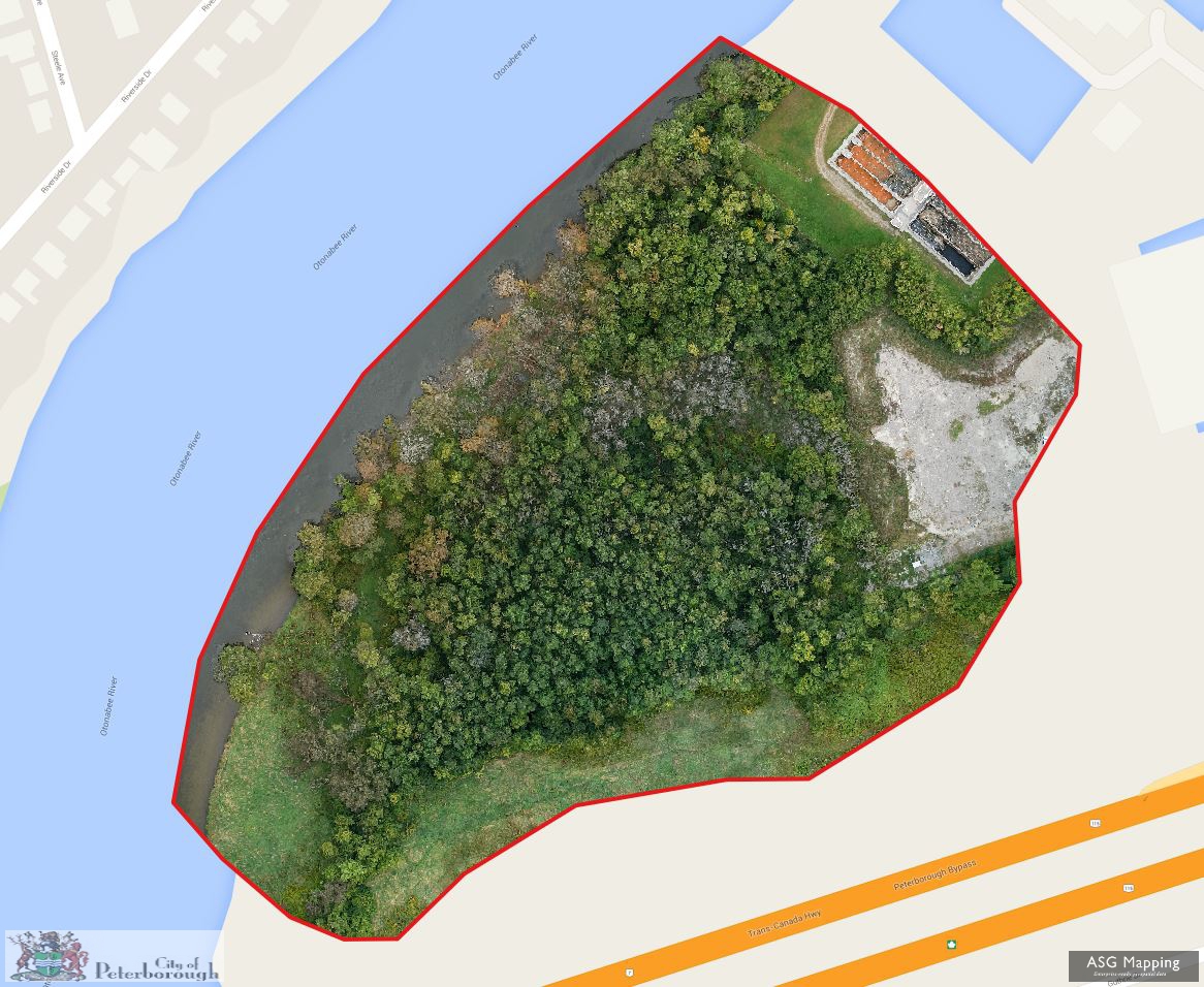
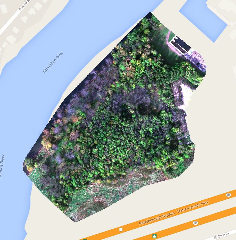
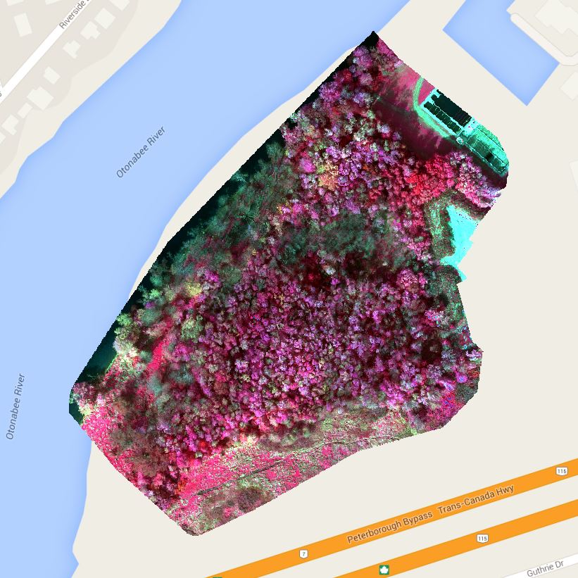
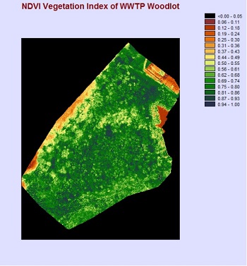
This project was with the City of Peterborough Public Works Department which also has responsibility for Parks and Trees. The project site is a woodlot approximately 6 hectares in size situated on the southern shores of the Otonabee River and directly beside a snow dump and the city’s Waste Water Treatment Plant (WWTP). The project is part of an on-going investigation into the apparent poor health of some trees in the woodlot.
ASG Mapping Ltd collected high resolution aerial imagery using a multirotor RPAS system on three occasions during the growth season to produce a series of orthomosaic imagery of the woodlot foliage so that tree foliage can be compared over the summer months. To allow overlaying of other geospatial/GIS data over the orthomosaic imagery the data collection was designed to meet a horizontal accuracy of better than 1 metre.
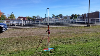
A multirotor RPAS with its Vertical and Takeoff Landing (VTOL) capability was used to collect the aerial imagery due to the site’s proximity to WWTP buildings and Highway 7. A Sony Nex 5 mirrorless digital camera was used for the first two data collections while a MicaSense RedEdge 5-band multispectral camera was used for the third data collection. Photo targets were laid out within the site to serve as Ground Control Points (GCPs) and as Check Points.
The resulting imagery clearly shows the distribution of dead and unhealthy trees within the woodlot. It appears that they follow the path of the water outflow from the snow dump and down towards the river bank. This is critical and important data that biologists, foresters, and other specialist can use in their ongoing investigation of the factors contributing to the unhealthy trees in the woodlot and ultimately finding solutions to mitigate the effects.